A CENTRAL COAST WINTER HIKE
Let's take a hike. We'll make someplace between a 400 and 500 foot elevation change. I can't be more certain because topographic maps differ. We start at sea level and walk what is called The Coyote Trail. It is often littered with Coyote scat and as it climbs it winds between Monterrey Pine thickets and other habitat of small animals.
The climb is gradual until about here.
A thick Pine forest is to your right, with a small patch of trees to your left
and the trail is pitched up and rutted.
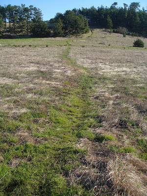
Once you clear the thicket you begin a long trek toward the crown.
Here you begin to get a peak of the Santa Lucia Range
Looking back toward the Pacific you can see the break to the slope.
Then you begin the hike across the top of the hill.
Above you are looking due west.
This is looking east, toward the Santa Lucias and the village, tucked into the Pines.
Here you are looking north west and toward the trail down to the bluff.
Down and into another a small patch of shrub and thicket.
Into the thicket you can begin to see the break of the slope and the altitude. The brown line about 1/3 from the top of the frame is large service road.
Approaching the thicket
Lot of poison oak grows here
The path is rutted from winter rains
Another view of thicket trail and elevation
The knees respond to this pitch
This is looking back up the incline
Then the trail flattens, and follows the coastal bluff
One of several handcrafted benches
On toward the south, and a completion of the loop
Every day provides a unique atmosphere and light play
The flat loop trail is two miles round trip. The climb adds another 1/2 to 3/4 of a mile depending on paths taken. It is a marvelous hike to watch the change of seasons and the always changing Pacific light and color show.
AND THEN A FAVORITE LUNCH SPOT
Rudell's Smokehouse on the strand in Cayucos is a favorite. The smoked fish tacos are incredible. So is the view.
A great place to "recharge" after a hike.


I like the flat parts. ;)
ReplyDelete