
REFILLING THE LAKE


An extraordinary story of our age is playing out in the vast expanse of the Mono Basin of the Owen Valley in
the Sierra Nevada range.
It is a story of short-sighted decisions rescinded and precious resources repaired. It underscores the effort of conservation ideas prevailing over economic power in the courts.

The satellite photo captures the lake basin's shrinkage.

Like many, my first vision of Mono Lake was the exotic Tufa sculptures. The otherworldly towers began to appear as the surface of Mono Lake began to recede. They are a limestone type of carbonate substance.
Mono lake is a terminal lake- there is no outlet to the ocean and by its composition is a saline soda lake. It has high salt content.
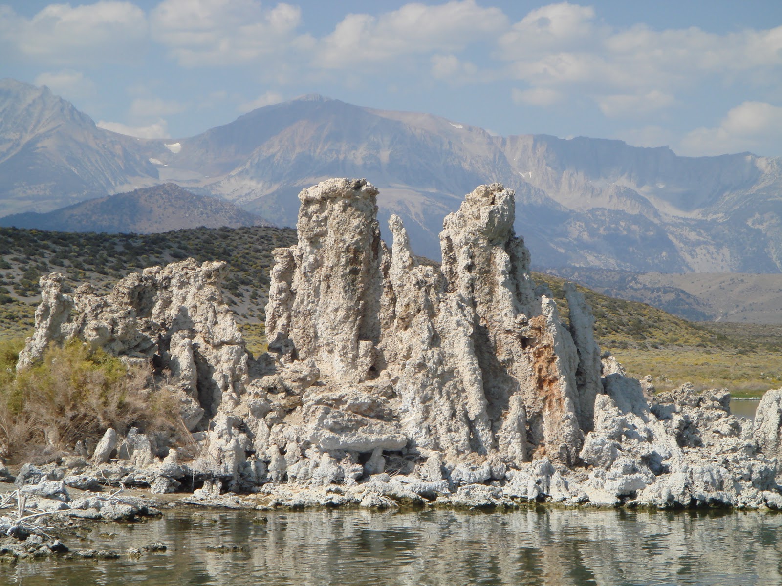
In 1941 the city of Los Angeles extended their aqueduct system hundreds of miles north into the Mono Basin where it began to drain the lake.

As the lake level dropped the Tufa Towers were increasingly exposed.

Big changes are underway at Mono Lake. These frames

of exposed Tufa were shot on one of our first trips in 2008.


The frames that follow below were shot in early October this year. You can see the towers are less prominent and that more grassland surrounds the lake.


In 1978 conservationists and environmentalists launched a battle to stop what would have been the eventual draining of Mono Lake. Since 1941 the lake dropped by 50 vertical feet and shrank in volume by one half.
Court action ensued. In 1990 LA was ordered to comply with Fish and Game Laws and in '94 the California courts ruled that Mono lake must be raised 19 feet. 25 feet less than where it was in 1941, it is enough to save the lake.

Recently this was exposed beach. In the past it was under water, as it will again be.

The marker indicates the water level in 1963.


This marks the 1941 water line when the draining began.

Negit, the black island to the right in the frame below was once separated from the shore by two miles of water. You can see the vestige of a land bridge, created by the draining. It was that bridge and the coyote and other predators who traveled it to nesting gull colonies that helped spur the fish and wildlife regulatory support which bolstered the efforts to force LA to stop killing the lake.


Mono Lake may never get back to this level, but the water is rising and good sense prevails.

SURVIVING SANDY
This may be THE monster storm in current history, at least it has that potential. It is worrisome that unprecedented-at least in our modern historic records-weather events continue to accumulate. In this case natural elements have combined to amplify the power and severity of the storm. There should be full inquiry as to how human activity contributes or exacerbates, but there should also be a concerted global study of what can be done. And, as the first concern now is safety and security of those in the storms path, we need to begin to address how we can effectively survive without casualties to humans and our lifestyle. Are there better ways to transmit power than by lines, hung on poles? Can the grid go underground? Can builders and architects design and construct with built-in emergency generation systems? Should we be more prudent about where home's are constructed and where populations settle?
These are tough questions, but ....
And a final thought---can't we watch weather coverage
without people standing out in the wind, or wading in water or snow? Just show the footage! Allow photographers to execute their skill. Watching someone hang on in a gale is just silly and maybe even stupid.
See you down the trail.